Land Navigation
Available Subcategories :
| Physical Security | M203 | M240B | M249 | M4 | M60 | M72 | M9 | Maintenance | Military Justice | MK19 | NCO Duties. Responsibilities, Authorities | NCO History | NCOER | M2 | Physical Training | Promotions and Reductions | Security and Intelligence | Supply Economy | Survival | The Army Plan | Training the Force | Uniforms | U.S. Constitution | Weight Control | Study Guide Files | Drill and Ceremony | Army Programs | AT4 | Awards and Decorations | Battle Focused Training | Camo and Concealment | CBRN | Chain of Command | Code of Conduct | Communications | Counseling | Customs and courtesies | Desert Operations | Army History | Field Sanitation | First Aid | Flags | Geneva Convention | Guard Duty | Hand Grenades | Land Navigation | Leadership | Leaves and Passes | M11 | M16 | M18A1 |
» Different Types of Maps Explained
Types of regular maps and also map substitutes
» Setting up a land navigation course land navigation course
Basic guidelines to use when setting up a land navigation course
 » Measure Distance
Measure distance on a military map using ruler or paper and the bar scales
» FM 3-25.26
MAP READING AND LAND NAVIGATION
» Night Navigation
Darkness presents its own characteristics for land navigation because of limited or no visibility.
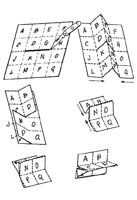 » How to slit and fold a map for special use
Before attempting to cut and fold a map, make a practice cut and fold with a piece of paper
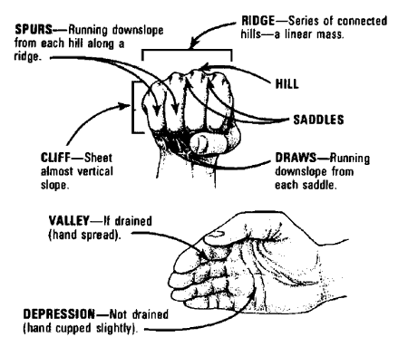 » Identify Major / Minor Terrain Features
Hill, Ridge, Valley, Saddle, Depression, Draw, Spur and Cliff
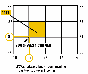 » Grid Coordinates
Finding your location on a map using grid coordinates
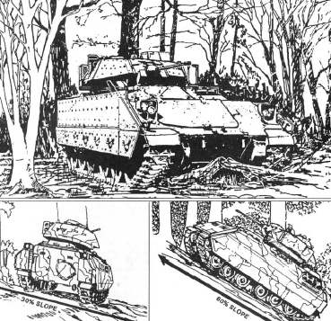 » Mounted Land Navigation
A vehicle commander should be able to navigate from one point on the ground to another with or without a compass.
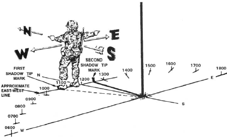 » Field-Expedient Methods of Determining Direction
When a compass is not available, different techniques may be used to determine the four cardinal directions.
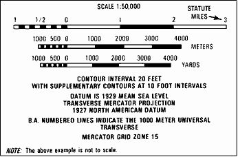
» Marginal information found on a military map
The marginal information and symbols is where useful information telling about the map is located and explained
» How to use pace count to measure ground distance
A pace is equal to one natural step, about 30 inches long.
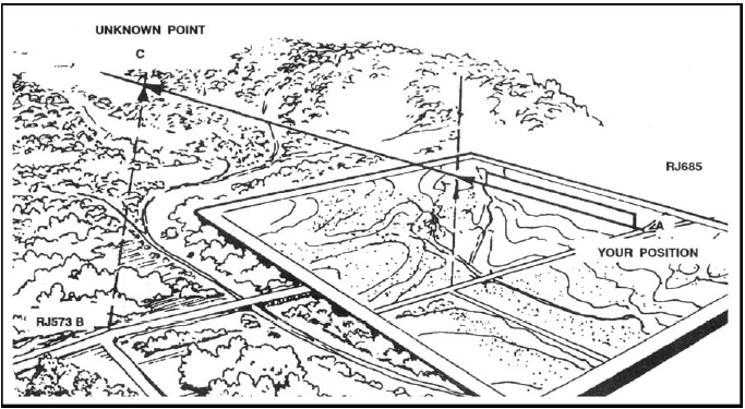
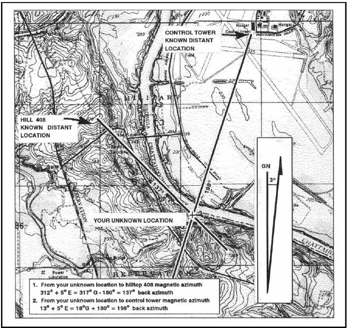 » Find Your Location Using Resection
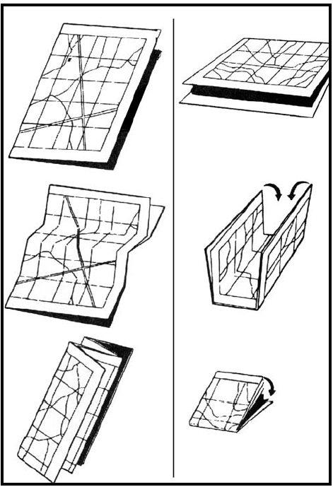 » Map Folding Techniques
Two different ways to fold a military map
 » Find a location using Intersection