Measure Distance
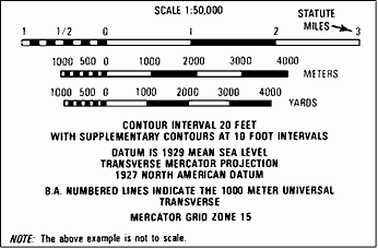
Soldiers can use their maps to measure the distance between two places. The maps are drawn to scale. This means that a certain distance on a map equals a certain distance on the earth. The scale is printed at the bottom and top of each map (Scale 1:50,000). This means that 1 inch on the map equals 50,000 inches on the ground. To change map distance to miles, meters, or yards, use the bar scales at the bottom of the map.

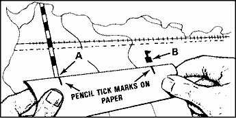
Take a ruler or the edge of a piece of paper and mark on it the straight line distance between your two points.

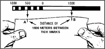
Then, put the ruler or the paper just under one of the bar scales and read the ground distance in miles, meters, or yards. The bar scale here shows a ground distance of 1,500 meters.
