Land Navigation
Available Subcategories :
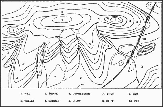 » Interpretation of Terrain Features
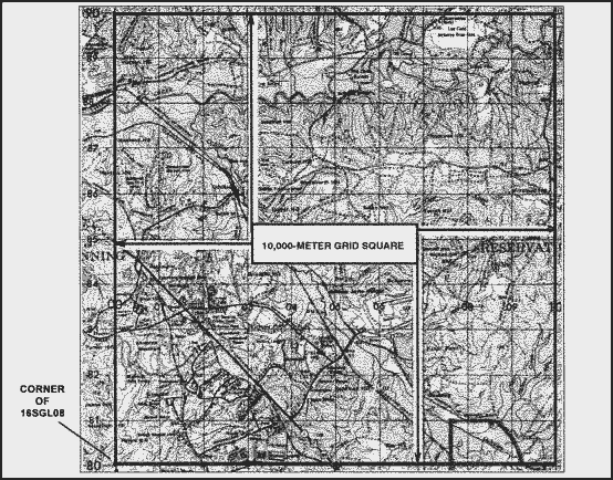 » Locate a point using the US Army Military Grid Reference System (MGRS)
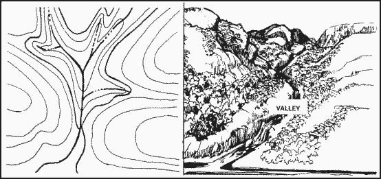 » Valley (Major Terrain Feature)
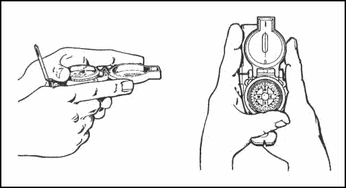 » Handling A Compass
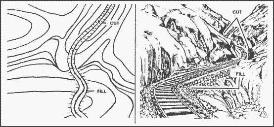 » Cut and a Fill (Supplementary Terrain Features)
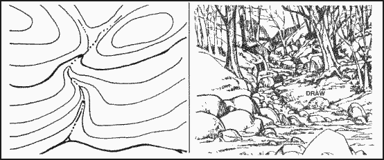 » Draw (Minor Terrain Feature)
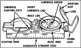 » Determine a Magnetic Azimuth Using a Lensatic Compass
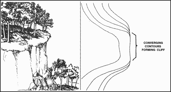 » Cliff (Minor Terrain Feature)
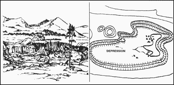 » Depression (Major Terrain Feature)
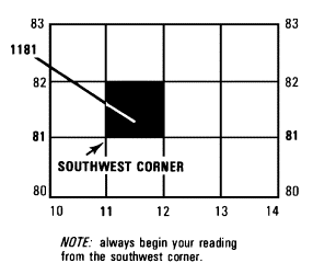 » Determine the grid coordinates of a point on a military map
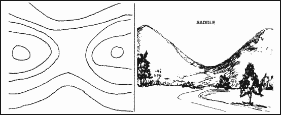 » Saddle (Major Terrain Feature)
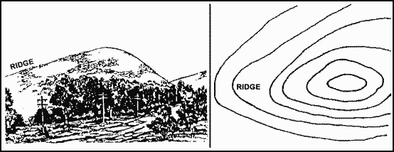 » Ridge (Major Terrain Feature)
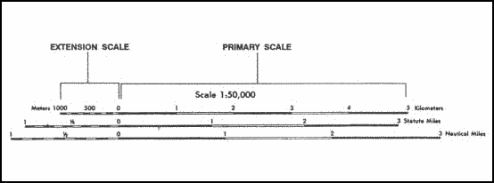 » Measure Distance on a Military Map
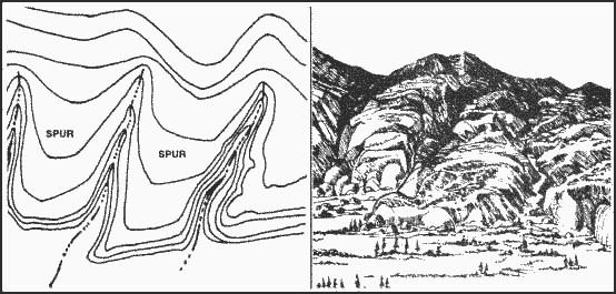 » Spur (Minor Terrain Feature)
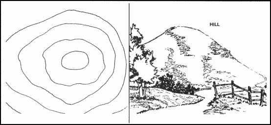 » Hill (Major Terrain Feature)